
 How to resolve AdBlock issue?
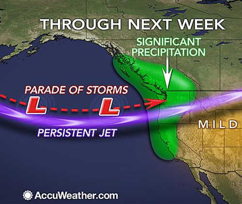
NORTHERN CALIFORNIA – AccuWeather's Global Weather Center reports that a long train of storms over the Pacific Ocean is on an express route to Northern California and the coastal Northwest and will deliver rounds of drenching rain into the middle of December.
The weather pattern through the middle of the month has the potential to bring 6 to 12 inches of rain from Northern California to western Washington state and yards of snow to the high country of the northern Sierra Nevada and Cascades.
While much less rain and high country snow are likely to fall farther south in California, there will be a few rounds of needed moisture.
The storm from this past Tuesday and Wednesday was only the beginning of a pattern that will deliver moisture in the form of rain and high-country snow to the West Coast.
Much more rain on a gradual basis is needed to alleviate the extreme to exceptional drought conditions extending back several years, centered on California.
Since the start of 2013 and prior to the storm of Dec. 2 and 3, a rainfall deficit of 1 to 2 feet was common in the region with even greater deficits in some areas.
The Tuesday-Wednesday storm delivered an average of 1 to 3 inches of rain to California with locally higher and lower amounts.
Rainfall from the storm was 2.53 inches at San Diego, 2.96 inches at Sacramento and 3.56 inches at San Francisco. Enough rain fell to cause isolated urban-style flooding, as well as mudslides.
The next storm in the train will reach the California, Oregon and Washington coasts Friday afternoon and will continue into early Saturday.
The bulk of this rain will fall from Northern California to Oregon, where a general 1 to 2 inches are likely.
Northern California's Lake County is expected to see a maximum of just over an inch of rain from Friday through Saturday, according to the forecast.
Locally higher amounts of rain are possible in the west and southwest-facing slopes of the coastal ranges, northern Sierra Nevada and Cascades. Very spotty showers may reach as far south as the Los Angeles Basin.
Snow levels with the Friday night storm will be generally above 7,500 feet in the northern Sierra Nevada, but some ice and snow can occur at pass level in the northern Cascades.
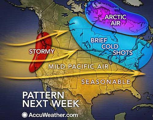
There will be a little break from the storms during the middle of this weekend.
However, another storm is due to roll in from the Pacific Sunday night.
Essentially, storms are likely to arrive along the West Coast every other day or so.
There is the potential for a large storm to swing onshore later next week, which could spread heavy rain into Southern California.
Any of the storms through the middle of the month will bring a risk of renewed isolated flooding and mudslides.
Alex Sosnowski is an expert senior meteorologist for www.AccuWeather.com .


