
 How to resolve AdBlock issue?
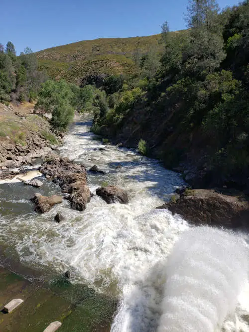
Dear Lady of the Lake,
I just moved to Lake County and live next to the lake. I heard the other day that Lake County doesn’t have water rights to Clear Lake? Is that correct? Can I take water from the lake to irrigate my garden? I also have a pond on my property and a well, who has rights to those sources of water?
Thanks for clearing this up!
— Wondering about Water Rights Walter
Walter,
Thank you for asking these questions. I get asked about water rights quite a bit actually. You are right about Clear Lake’s water rights — they actually belong to Yolo County. Anyone who takes water from the Lake — beyond riparian rights (we will talk about these below) — has to compensate Yolo County. This also applies to the streams that flow into Clear Lake. Basically, any water that would eventually flow through Clear Lake and into Cache Creek and through the Cache Creek dam is considered “property of Yolo County” and they can charge a user for diverting or selling that water.
The story about Clear Lake water rights is old, going back more than 100 years. There have been some modifications to the rights over the years to protect the sustainability of Clear Lake, to ensure there is water in the Lake to provide for the residents of Lake County who live around the lake and to protect the habitat of the lake for wildlife and recreation.
Water rights is a big topic, but very important. Water rights — and the registration and accounting of those rights — are important to the local, regional, and state managers of water resources. Without an accurate record of who is using water, where the water is coming from and what the water is being used for, water in the west can not be managed for long-term sustainability and the resource will literally go dry.
Please note that today’s column will not cover California Tribal Water rights, but know that in general tribal water rights, for federally recognized tribes, are governed by the Winters doctrine. This doctrine basically contains two principals; 1) federally reserved lands have a right to use sufficient water to fulfill the “primary purpose” of the reservation, and 2) these water rights cannot be destroyed by state water law or by water users acting in accordance with state law.
However, there are specific uses and rights determined by each individual tribe and lands in hand. For more information on the Winters Doctrine, I recommend this brief review from the Congressional Research Service by C. Broughner (2011).
There are also many complex issues arising when conflict around water rights and resources are strained, especially when it comes to tribal beneficial use and the demands of agriculture and hydropower generation that maintains the economy of the state. Again, this important and vital topic is way beyond the scope of today’s column, but a great book to read that dives into tribes, water use and conflict in California is “Upstream: Trust Lands and Power on the Feather River” By Dr. Beth Middleton of UC Davis (Available from University of Arizona Press). I highly recommend this read.
If you have questions about current rules and regulations for water rights in general, I suggest you refer to the State Water Resource Control Boards Water Rights Frequently Asked Questions. This page provides a plethora of information in a quick, easy format to find information related to any situation regarding water rights or water law in California.
Yolo County water rights
While I will cover some details here, and there are many details, be aware that there is a nice historical summary provided on the Water Resources Department webpage on “How Yolo County Acquired Water Rights.”
About 1908, the Yolo Water and Power Co., which purchased holdings and land from the Moore Ditch Company based in Yolo County, applied for 300,000 miners inches of water rights from Cache Creek, including Clear Lake and her tributaries. A miner’s inch is actually a unit of flow, but it varies between 1/36 and 1/60 cubic feet per second depending on where in the world the term is being used. The “inch” reference actually indicates the size, in square inches, of a hole and how much water would pass through in hydraulic mining operations. Today, this is translated to about 230,000 acre-feet of Clear Lake water.
In 1912 the Yolo Water and Power Co. application for Cache Creek water coincided with the construction of a dam on Cache Creek, near the current location of the Cache Creek Dam. It’s unclear exactly how much interest Lake County had in the water flowing through Cache Creek, but when the Board of Supervisors was asked if they wanted to also apply for the water rights, apparently they said no, and the Yolo Water and Power Co. was given priority rights.
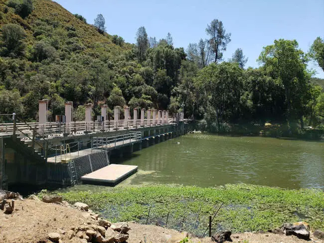
In 1927, Yolo Water and Power Co. was purchased by the Clear Lake Water Company, and in 1967, Yolo County residents voted to purchase the Clear Lake Water Company (and it’s rights) for about $2M in bonds. Before this in 1951, the Yolo County Flood Control and Water Conservation District, or YCFCWCD, was established by the state legislature to conjunctively manage surface and ground water resources in Yolo County. The YCFCWCD now manages the Cache Creek dam,
Indian Valley Reservoir, Chapman Reservoir, and manages the “world’s longest inflatable rubber dam” as part of the Capay Diversion Dam project.
YCFCWCD can continue to hold rights to Cache Creek, Clear Lake storage, and her tributaries as long as they continue to put the water to beneficial use and irrigation. This is called a “vested right”. As long as YCFCWCD is demonstrating that they are 1) Using the water and 2) using the water for beneficial use (i.e. irrigation, drinking water, storage), or uses accepted as appropriate or non improper exercise of the right, they can continue to hold their permitted right to Clear Lake waters and her tributaries.
Yolo has an even longer history using water from Cache Creek, according to the YCFCWCD, “The appropriated water right on Cache Creek in Yolo County has a priority of December 4, 1855. Through Permit No. 19162, issued by the State Water Resources Control Board (State Board), the District also has the right to utilize water from Clear Lake for hydroelectric power generation.”
Additionally there have been three decrees that have modified and clarified when and how Yolo can take and use water:
The 1920 Gopcevic Decree maintains Clear Lake water level between zero and 7.76 Rumsey. Basically Yolo can’t take water when Clear Lake is below the level where it naturally flows through Cache Creek and they can’t close the dam when they have too much water, creating lake level to exceed 7.76 Rumsey, leading to flooding. This Decree helps regulate water storage and prevents flooding of shoreline properties around Clear Lake.
The 1940 Bemmerly Decree prevents anyone from altering the shape or size of Cache Creek between Clear Lake and the Dam so that water that flows from the lake past the Grigsby riffle is a natural flow and not altered to allow more/less flow then what would naturally be occurring. For more details on the Grigsby Riffle, refer to my column from Oct. 17, “Learning about Lake Levels.”
The 1978/1995 Revised Solano Decree maintains the timing of water withdrawal by Yolo from Clear Lake based on spring water levels. Much like what happened during the 2021 drought season, the Lake did not reach a level above 3.22 feet Rumsey on May 1, so Yolo could not release any water.
Waters not beholden to Yolo County water rights
Walter, you asked about other surface waters and if they are included in the rights of Yolo County. If there is a natural flow of water to Clear Lake, and that water would contribute to the 230,000 acre feet of water they have rights to, then that water belongs to Yolo. If the water stays in an isolated pond, marsh, wetland, or a creek or stream that does not flow Clear Lake, then it’s not subjected to Yolo water rights.
There are some other types of rights to be aware of when it comes to surface and groundwater sources of water. Here are some terms and descriptions, but keep in mind that there are some variations among these terms depending on the sources you are referencing.
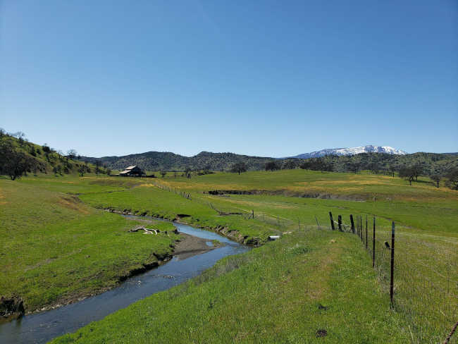
Riparian rights. A Landowner who has land adjacent to a water source can use that water on their land. Riparian rights are as old as California’s statehood, originally used to encourage agriculture development in the early formation of the state. One thing to note about riparian rights is that they are not lost if not used, which can create some uncertainty to neighbors or water users downstream, for example.
Anyone who uses water from Clear Lake (or her tributaries), who uses water exceeding the rights afforded for riparian rights (The maximum use allowed under such a registration is 4,500 gallons per day for immediate use or 10 acre-feet per year for storage in a pond or reservoir) are responsible for compensating YCFCWCD, as they are the legal holder of the water right of that water source and these amounts exceed reasonable riparian right use.
Drinking water systems and purveyors located along the lake have an appropriative right agreement with YCFCWCD, meaning they report the monthly amount of water they take from the lake and what they sell. Some of the water sold by the purveyors goes to those properties who would have natural riparian rights, so there is some “littoral credit” given back to offset overall costs of water to the purveyors based on the number of properties who could claim riparian rights.
There could be a need for small domestic or diversion to storage permit if you are using water for livestock watering, irrigation, and storage for times when there is less water. That type of permit is more like a registration, through the state, requires an annual report and can help ensure that a specific water source is not being depleted when considering all the water uses and users. The state would really like all water users to register and report on their water use so that tracking and accounting of all water uses is comprehensive and actually effective.
Riparian rights apply to a pond or stream that is located on private property; only the landowner can use the water from those sources as long as they don’t interfere with someone else’s riparian right. In other words, someone downstream also has a right to access and use that water and your upstream activities can’t dry up the stream therefore inhibiting the downstream users rights.
Walter, you had asked about being able to use Clear Lake water for private use in your garden, and the answer is yes, as long as you only use the water on your own property and aren’t selling it or diverting it to someone who does not have riparian rights. Unless of course there is an agreement in place for an appropriative right between you, the state, and another water user.
Appropriative water rights. These are basically diversion or diverter rights, usually made with an agreement to a riparian rights holder. According to the Water Education Foundation, “California law allows surface water to be diverted at one point and used (appropriated) beneficially at a separate point….This is in contrast to a riparian right, which is based on ownership of the property adjacent to the water.”
Appropriative rights require a permit or license and can apply to surface water and groundwater, but according to the 1914 Water Commission Act, all diversions must acquire a permit with the State Water Resources Control Board, and the Board is charged with keeping records of all appropriations. This record-keeping is very important so that water can be managed appropriately so the resource doesn’t become exhausted.
In times of water shortage or drought, the most recent appropriative claims on the water source will be denied or curtailed, and in cases where there is extreme water shortage, all claims could be retracted to prevent exhaustion of the water source.
Groundwater law and groundwater water rights
This last type of water right — and management — is very tricky, and dare I say, evolving in real-time, as we all learn more about the amount of water that exists sub surface, or in the ground, from an aquifer, known as groundwater.
In California a landowner has rights to pump a reasonable amount of groundwater from a well on their own property and use it for an appropriate, non-wasteful manner. That definition might sound ambiguous and subjective to you, but that is why the groundwater law and groundwater management is such a topical subject of California water resource efforts right now. The courts are constantly refining these types of terms and definitions.
A groundwater basin is an area where all ground water in an area is connected, think of this as the underground “watershed.” Groundwater management focuses on safe yield of a basin, meaning the amount of water being extracted from the aquifer does not exceed the water entering the aquifer over a water year. When water extraction is greater than water inputs (precipitation, snowmelt, storm water runoff, etc) ,overdraft is occurring in a groundwater basin.
According to the Water Education Foundation, “Overdraft occurs when, over a period of years, more water is pumped from a groundwater basin than is replaced from all sources – such as rainfall, irrigation water, streams fed by mountain runoff and intentional recharge.” Some residents of Lake County experienced lowering of groundwater levels (overdraft has not been documented, the basin rebounds during a wet year) first hand this year during the drought where their well ran dry, limiting their ability to access clean, fresh water for private, commercial, or domestic use.
Across all of California we use more groundwater, two million acre-feet to be exact, than is being replaced, or recharged into the source. Some areas are at higher risk of overdraft than others, and the state is prioritizing those areas for improved groundwater management. The Big Valley Basin is the highest priority groundwater basin in Lake County (technically labeled a medium priority basin) and the subject of an intense and expensive groundwater sustainability plan development.
For more information on that project and how you can be involved (and if you live in the Big Valley - Finley - Kelseyville area, you should be!) you can visit the Lake County Department of Water Resources Big Valley Groundwater Webpage here.
For general groundwater information, including opportunities for well monitoring and well maintenance resources like grants and loans, you can visit the general Groundwater Management website here.
Now Walter, if you are interested in having your well monitored so that you can track your use and the status of the aquifer, Lake County Water Resources is looking for more landowners to participate in a local well monitoring program. Participation in the program includes two measurements a year (spring and fall) and your well data is available by your request at any time and would only be used by the County to better understand the current state of the groundwater resources and how to manage them going into the future.
If you are interested there is a simple survey here that will connect you and the groundwater monitoring staff at Water Resources. Once you fill out this survey, a staffer will contact you to get more information and answer any of your questions. If you are interested but want more information first, you can call Water Resources directly at 707-263-2344.
The connection between surface and groundwater
Due to the unique nature of groundwater compared to surface water, the historic management of groundwater use has been left up to local officials and agencies. For example, the local Lake County Environmental Health Department issues well permits for new wells in Lake County, although they are not a water management resource agency.
The roots in groundwater in the state have been separate from those governing surface water, almost as if they are disconnected concepts. However, the fields of ecology, geology, hydrology, and biology have demonstrated that surface and groundwater are very much connected and influence each other in the physical, chemical, and biological sense. You can not effectively manage one without managing the other.
Healthy and plentiful surface water depends on a healthy aquifer and vice versa. Therefore the state is rethinking and reinventing the management of groundwater - mostly through the development of localized basin-specific Groundwater Sustainability Plans. This management need is becoming more and more urgent as climate change has led to the reduction in the snow melt and precipitation predicted and available to recharge groundwater - and surface water supplies- to meet everyone's needs.
While this topic is vast and I could write 100 columns or more on water rights and water as a resource, I will end today with a quote from the California Water Blog. This post, from October 2014, was written by Dr. Ted Grantham, currently of UC Berkerely, who has worked on many projects involving the intersections of water quantity, quality, science and politics. This quote is more than five years old - but it still very much applies.
“California is suffering the third driest year in a century and demands for water are at an all-time high. The huge gap between allocations and natural flows — coupled with great uncertainty over water-rights holders’ actual usage — is increasingly creating conflicts between water users and confusion for water managers trying to figure out whose supplies should be curtailed during a drought. [Basically, when it comes to ] Water Rights: You can’t manage what you can’t measure.”
Sincerely,
Lady of the Lake
Angela De Palma-Dow is a limnologist (limnology = study of fresh inland waters) who lives and works in Lake County. Born in Northern California, she has a Master of Science from Michigan State University. She is a Certified Lake Manager from the North American Lake Management Society, or NALMS, and she is the current president/chair of the California chapter of the Society for Freshwater Science. She can be reached at This email address is being protected from spambots. You need JavaScript enabled to view it..
If you think someone is illegal diverting water from Clear Lake or her tributaries, meaning they are taking water without a permit or without a riparian right (i.e. does not live on the lake) you can report this activity directly to Yolo County Flood Control and Water Conservation District at Phone: 530-662-0265 or to the email This email address is being protected from spambots. You need JavaScript enabled to view it. or submit a comment on their webpage.
Thanks to Kristin Sicke (YCFCWCD), Ted Grantham (UC Davis Center for Watershed Sciences), and Joshua Viers (Center for Information Technology Research in the Interest of Society (CITRIS) at UC Merced.) and for providing information for this column.


